国土地理院では今月初旬に発生した九州豪雨の被害箇所の空撮写真などの情報をホームページで掲載しています。その中で、ヘリやUAVを使用して正射画像を撮影し、被災前と後をひと目で見られる地図を公開しています。被害状況を確認できることにより、復旧活動などに役立てられると思われます。
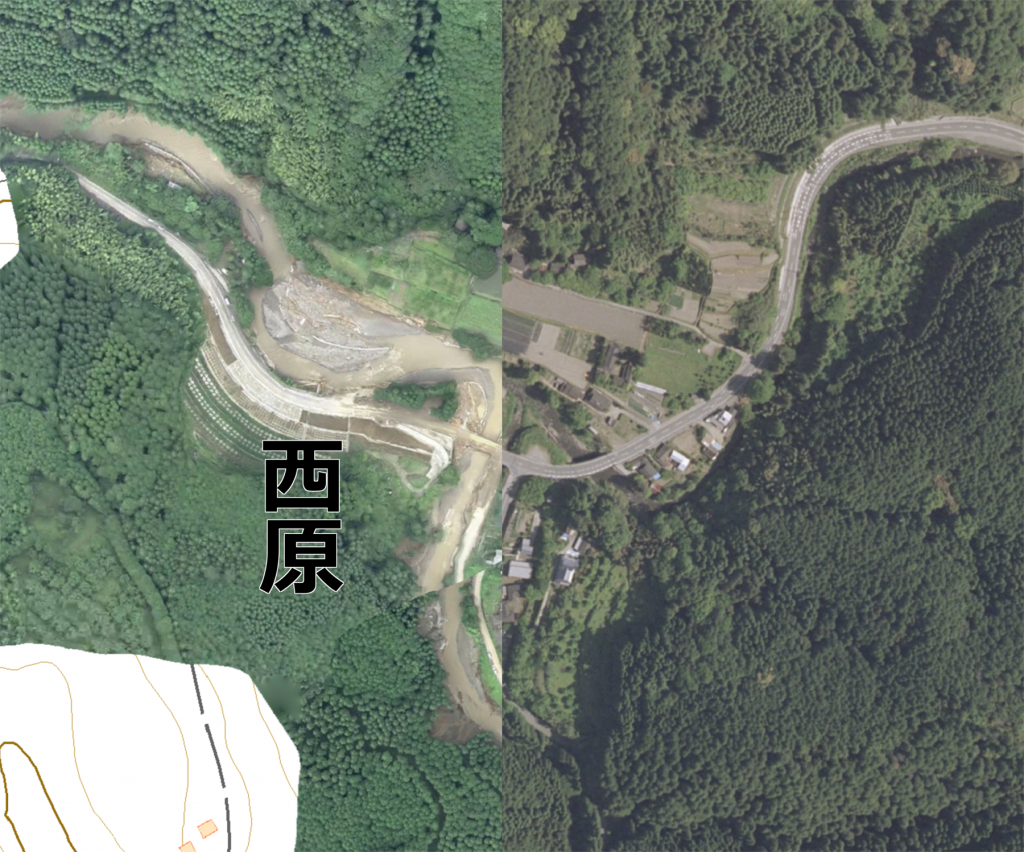
↓出典:朝倉市黒川西原地区【7月8日撮影】(国土地理院)全国最新写真(シームレス)&lattr=朝倉市黒川西原地区(7/8撮影)#17/33.43637/130.76069比較
九州豪雨被害箇所の比較画像
Warning: Trying to access array offset on value of type bool in /home/shizensaigai/shizensaigai.or.jp/public_html/wp-content/themes/cocoon-master/tmp/eye-catch.php on line 19
Warning: Trying to access array offset on value of type bool in /home/shizensaigai/shizensaigai.or.jp/public_html/wp-content/themes/cocoon-master/tmp/eye-catch.php on line 20
Warning: Trying to access array offset on value of type bool in /home/shizensaigai/shizensaigai.or.jp/public_html/wp-content/themes/cocoon-master/tmp/eye-catch.php on line 21
コメント